一、部分代码
close all
clear
clc
rng('default');
%% 载入数据
data.S=[50,950,12]; %起点位置 横坐标与纵坐标需为50的倍数
data.E=[950,50,1]; %终点点位置 横坐标与纵坐标需为50的倍数
data.Obstacle=xlsread('data1.xls');
data.numObstacles=length(data.Obstacle(:,1));
%% 画图
figure
hold on
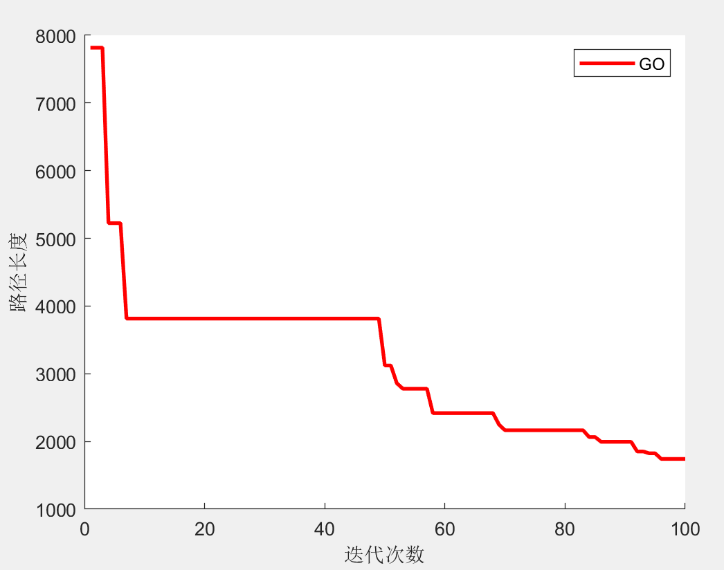
plot(curve,'r','LineWidth',2)
xlabel('迭代次数')
ylabel('路径长度')
legend(str);
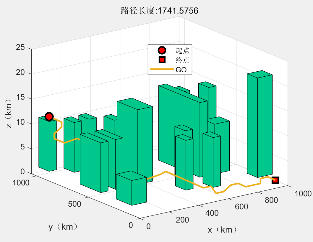
[~,result]=fobj(Best_pos);
drawPc(result,option,data,str)
result.path(:,1)=result.path(:,1).*data.unit(1);
result.path(:,2)=result.path(:,2).*data.unit(2);
result.path(:,3)=result.path(:,3).*data.unit(3);
%% 显示路径信息
fprintf("路径坐标:\n");
display(result.path)
fprintf("路径长度:%f\n",result.fit);
二、部分结果
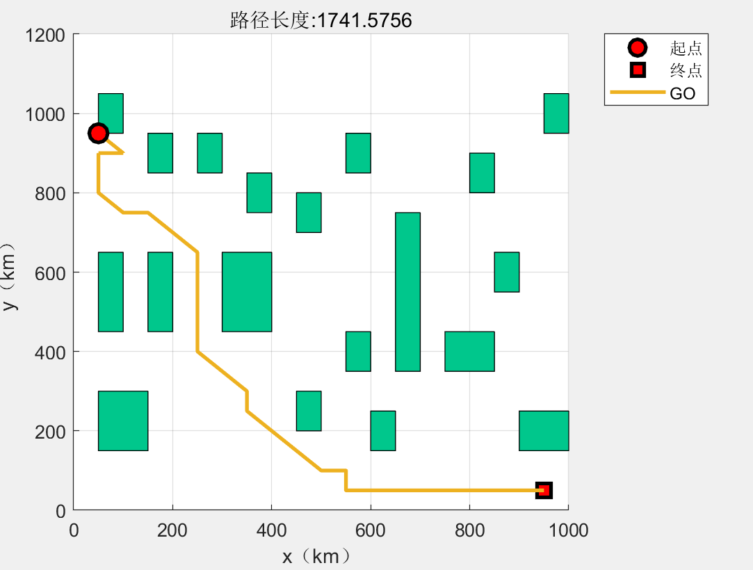
路径坐标:
50 950 12
100 900 11
100 900 10
50 900 9
50 900 8
50 850 8
50 800 8
100 750 9
150 750 8
200 700 7
250 650 7
250 600 6
250 550 5
250 550 4
250 600 3
250 550 2
250 550 1
250 500 1
250 450 2
250 400 3
300 350 3
350 300 4
350 250 5
400 200 4
450 150 3
500 100 2
550 100 2
550 50 1
600 50 1
650 50 2
700 50 2
750 50 1
800 50 1
850 50 1
850 50 2
900 50 2
950 50 1
路径长度:1741.575585
三、完整MATLAB代码