一、部分代码
close all
clear
clc
rng('default');
%% 载入数据
data.S=[50,950,12]; %起点位置 横坐标与纵坐标需为50的倍数
data.E=[950,50,1]; %终点点位置 横坐标与纵坐标需为50的倍数
data.Obstacle=xlsread('data1.xls');
data.numObstacles=length(data.Obstacle(:,1));
%% 画图
figure
hold on
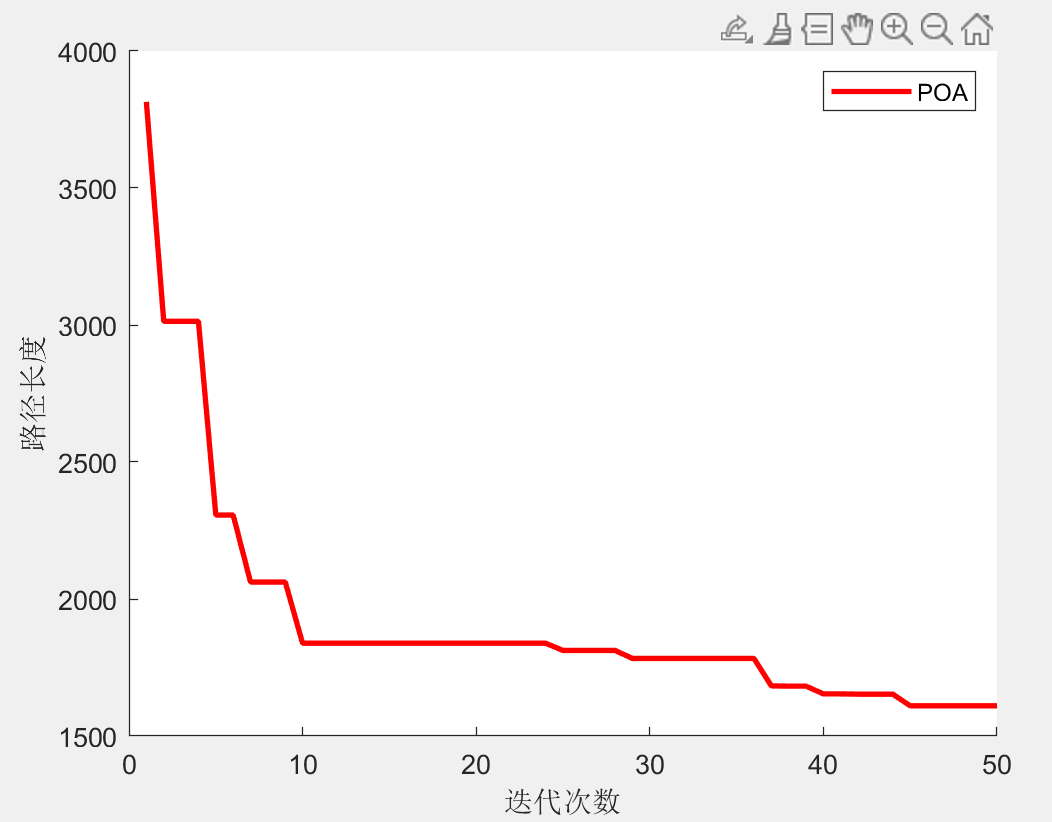
plot(curve,'r','LineWidth',2)
xlabel('迭代次数')
ylabel('路径长度')
legend(str);
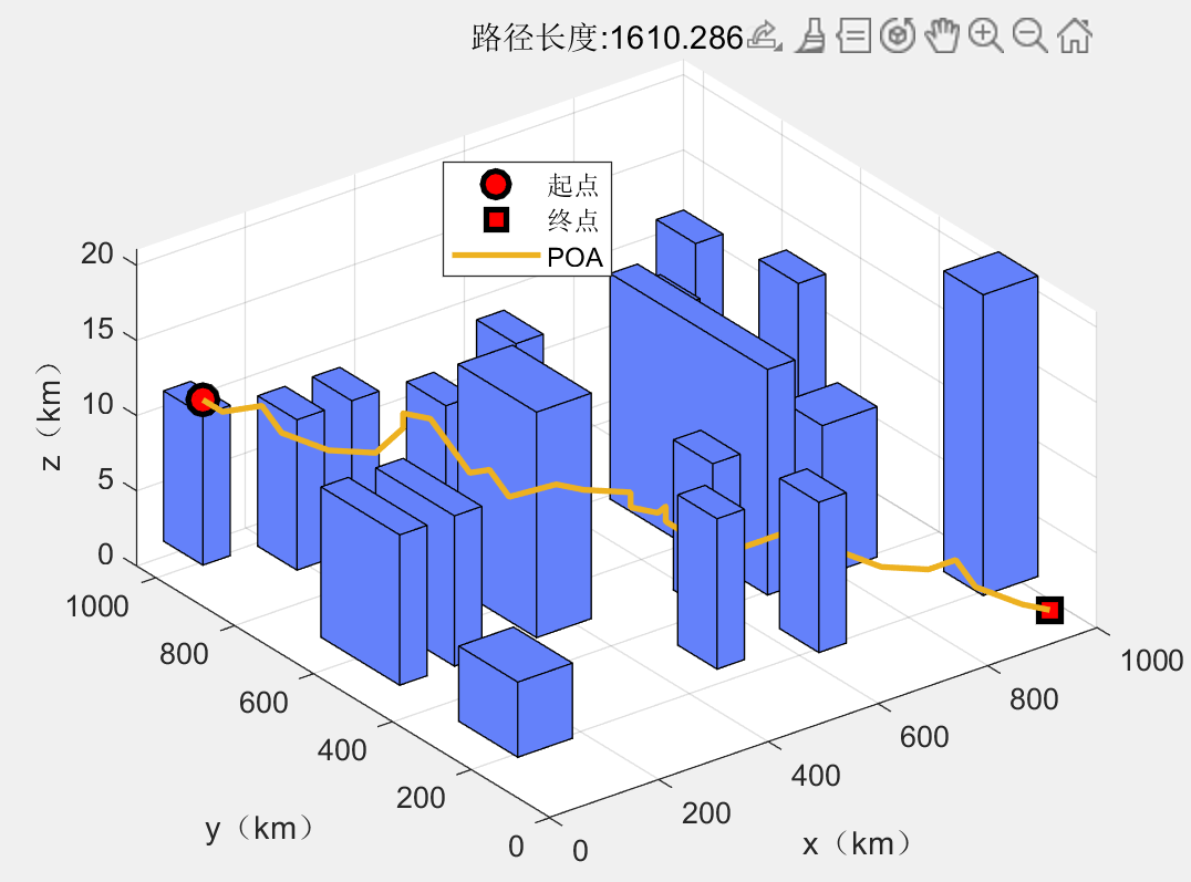
[~,result]=fobj(Best_pos);
drawPc(result,option,data,str)
result.path(:,1)=result.path(:,1).*data.unit(1);
result.path(:,2)=result.path(:,2).*data.unit(2);
result.path(:,3)=result.path(:,3).*data.unit(3);
%% 显示路径信息
fprintf("路径坐标:\n");
display(result.path)
fprintf("路径长度:%f\n",result.fit);
二、部分结果
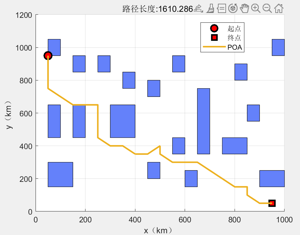
路径坐标:
50 950 12
50 900 12
50 850 13
50 800 14
50 750 13
100 700 12
150 650 12
200 650 13
200 650 14
250 650 13
250 600 12
250 550 11
250 500 12
250 450 11
300 400 12
350 400 11
400 350 11
400 350 10
450 350 9
500 400 8
500 400 7
500 350 7
550 300 6
600 300 6
650 300 6
700 250 5
750 200 4
800 150 4
850 150 4
850 100 3
900 50 2
950 50 1
路径长度:1610.286263
三、完整MATLAB代码